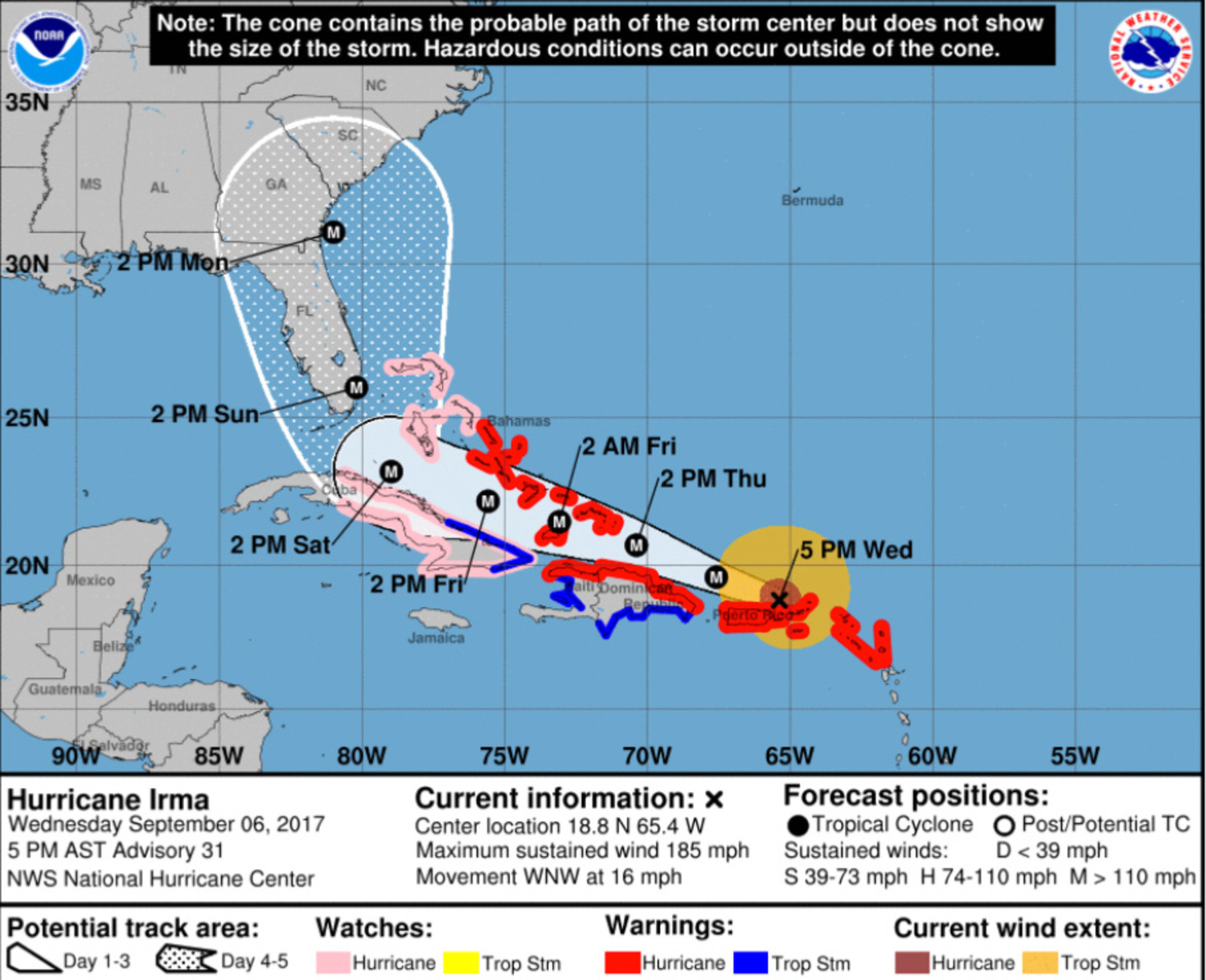
The National Weather Service out of Columbia said in its Thursday morning update that powerful Category 5 Hurricane Irma will likely affect the Clarendon County and midlands areas early next week, with a projected path following a similar one to Hurricane Matthew, which hit the area in October 2016.
Winds up to hurricane force are possible across the area early next week, especially in counties closer to the coast. These winds would cause damage to trees, signs, and outbuildings. Some damage to mobile homes would also be possible in areas that receive the strongest winds. Scattered power outages would be expected.
Locally heavy rainfall possible early next week of 3-6 inches, with isolated amounts to 10 inches. This amount of rain would cause a threat for some flash flooding, with some river flooding possible throughout next week.
Isolated tornadoes would be expected. Any locations directly affected by tornadoes could see damage to mobile homes, roofs, siding, and vehicles.
Irma already has battered the leeward islands and continues to move toward Florida's southern tip.
On Wednesday, the National Weather Service at the Greenville-Spartanburg airport was reporting low confidence on where and when the storm's track will shift as the storm approaches the Carolinas. Some tracks predict the storm will move over the Appalachian Mountains and others predict it will head out to the Atlantic, the weather service reports. The impact on local weather is unclear.
Though Irma is a Category 5 now, meteorologists say the ratings tend to change through the life of the storm. Regardless, any storm rated Category 3 or above is considered extremely dangerous, and even without making landfall, can cause devastation, according to the National Weather Service.